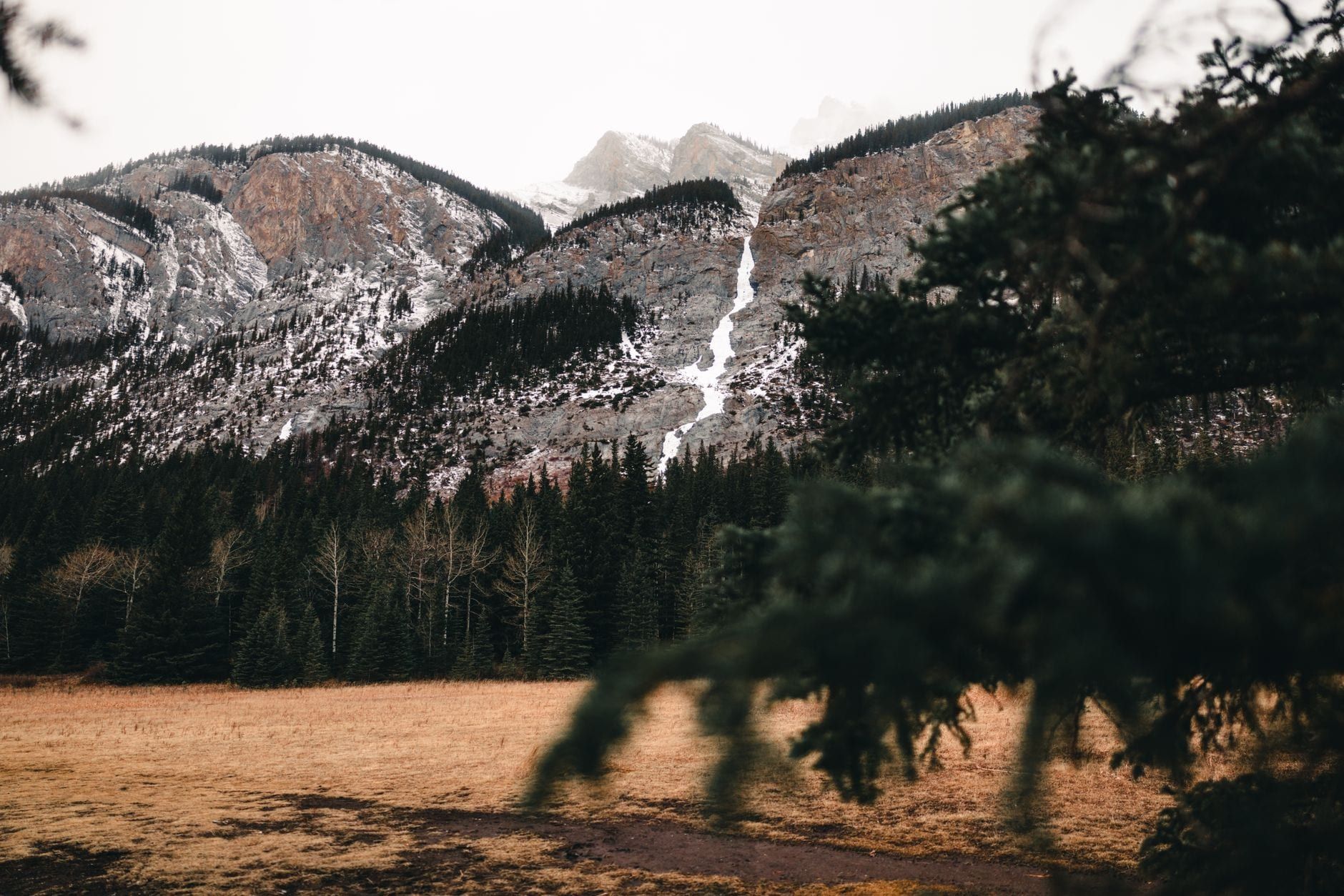
Glacial meltwater gives Banff's lakes their signature glow, and the park has far too many of them to see in one trip. Banff National Park spans 6,641 square kilometers of the Canadian Rockies, and hundreds of lakes and tarns sit inside that boundary, from roadside pull-offs to backcountry basins that take a full day to reach. This guide sticks to the ones worth planning around: the drive-up classics near town, the two icons everyone photographs, the string of stops along the Icefields Parkway, and the hikes that earn a lake all to yourself.
A few lakes that show up on nearly every 'Banff lakes' list, like Emerald Lake, actually sit across the border in a neighboring park. We'll flag those clearly, group everything else by how much effort it takes to reach, and end with a comparison table so you can match a lake to your itinerary instead of scrolling through thirty near-identical profiles.
Banff's Lakes at a Glance: Why They're So Blue
Glaciers grind bedrock into a fine powder called rock flour as they creep downhill, and meltwater carries that sediment straight into the lakes below. Suspended in the water, the particles scatter sunlight, and blue-green wavelengths bounce back strongest — the same mechanism that turns one lake milky jade and another electric turquoise, depending on sediment load and depth. The color peaks roughly June through September, when glacial melt runs highest. Drain that meltwater away in winter and the same lake looks almost black under the ice.
At 6,641 square kilometers, Banff holds far more lakes than any visitor could reasonably tour, and most guides settle on the same 10 to 30 accessible names. That's the approach here too — grouped by region and effort, so you can build a route instead of chasing a checklist.
One correction worth making early: several lakes that dominate 'Banff' round-ups aren't in Banff National Park at all. Emerald Lake sits in Yoho National Park, about 45 minutes west of Lake Louise, and Maligne Lake belongs to Jasper National Park, roughly four hours north. Both are worth a detour if you have the time — our Jasper vs Banff comparison covers the trade-offs — but neither shows up in the profiles below, which stick to lakes actually inside Banff's boundary.
Easy Lakes Near Banff Town (No Long Drive Required)
Four lakes sit within about a 20-minute drive of Banff townsite, and none of them require a hiking boot.
Vermilion Lakes
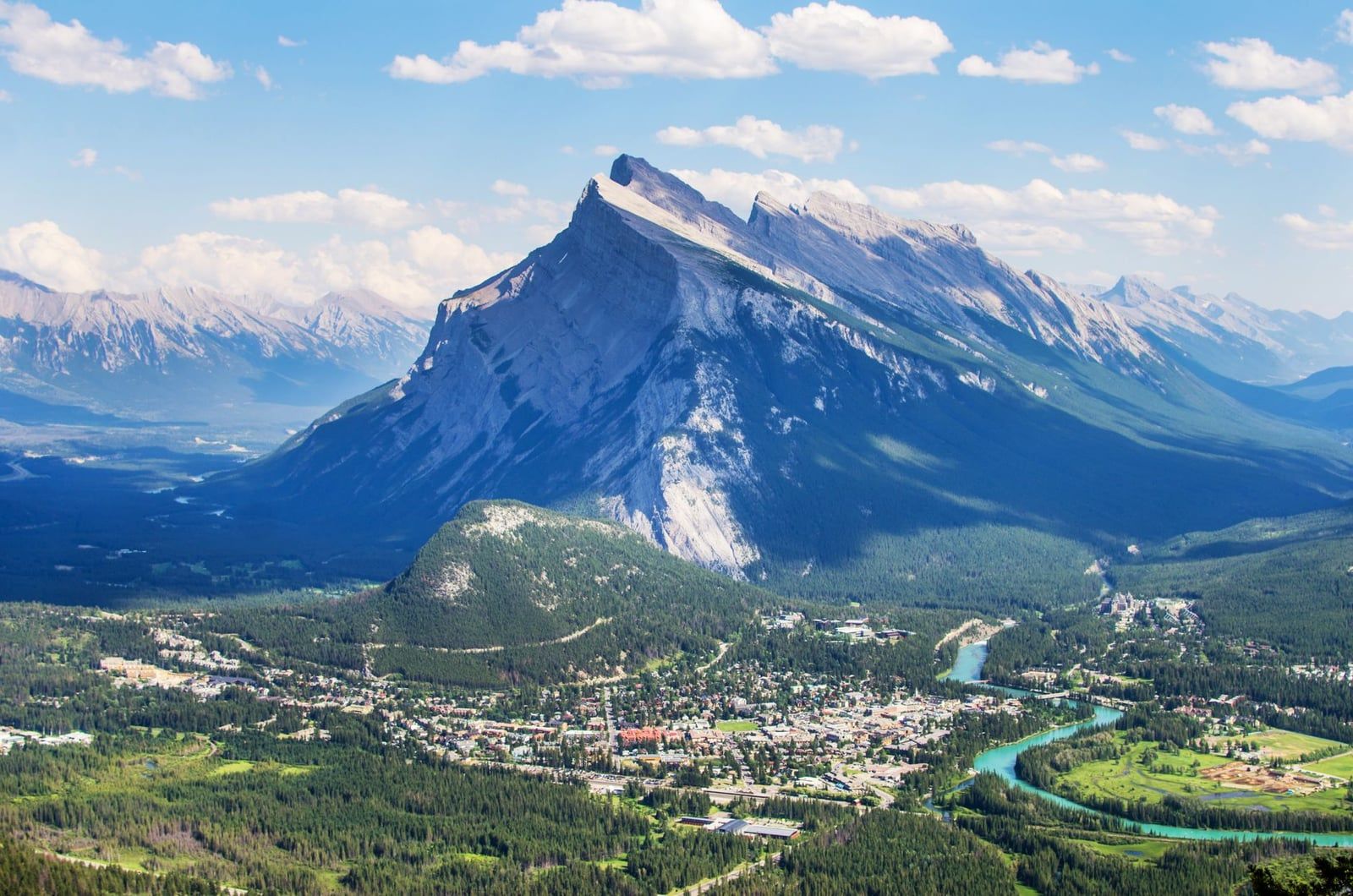
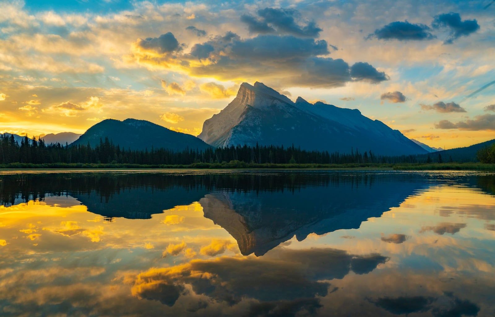
Vermilion Lakes are the closest lake stop to town, about 2.5 km down a quiet road off the Trans-Canada Highway. The three connected basins are shallow marshland rather than one deep lake, which makes them a magnet for waterfowl, elk, and the occasional beaver. Sunset lights up Mount Rundle across the water, and there's no fee or shuttle involved: just pull over and walk the shoreline.
Two Jack Lake
Two Jack Lake, about 10 minutes from town on the Lake Minnewanka loop road, is the park's easiest swimming and paddleboarding spot, with a shallow bay near the day-use area and a lakeside campground for anyone who wants to wake up beside it. In winter, a groomed stretch turns into a skating rink with Mount Rundle behind it. It runs quieter than Minnewanka next door, and it's the pick for families short on time.
Johnson Lake
Johnson Lake circles a small lake on a flat 3 km loop, and its water runs a few degrees warmer than most of the park's glacial lakes, which is why locals treat it as the default swimming hole. A rope swing near the east shore draws kids and teenagers on hot afternoons. It's the fallback when Two Jack's small lot is full, and honestly, some people prefer it.
Lake Minnewanka
Lake Minnewanka is the largest lake in Banff National Park, a reservoir roughly 21 km long and about 142 m deep, dammed for hydroelectric power with a flooded former resort town resting on its bed. It's also the only lake in the park where motorized boats are allowed, and a scenic cruise runs from the dock in summer past cliffs where bighorn sheep often graze. Want to spot wildlife while you're out there? Guided wildlife-watching tours frequently start right at this shoreline.
The Icons: Lake Louise and Moraine Lake (and How to Actually Get There)
These two lakes get more photos than the rest of the park combined, and the access rules for both have changed enough in recent years to trip up first-timers.
Lake Louise
Lake Louise owes its fame to the backdrop: Victoria Glacier hangs directly above the far shore, and the Fairmont Chateau sits at the near end, giving the scene a manicured, postcard symmetry. The lakeshore path is flat and takes 20-30 minutes round trip, easily the most accessible glacier view in the park. Come winter, a groomed section of the lake becomes a skating rink with the glacier still visible above.
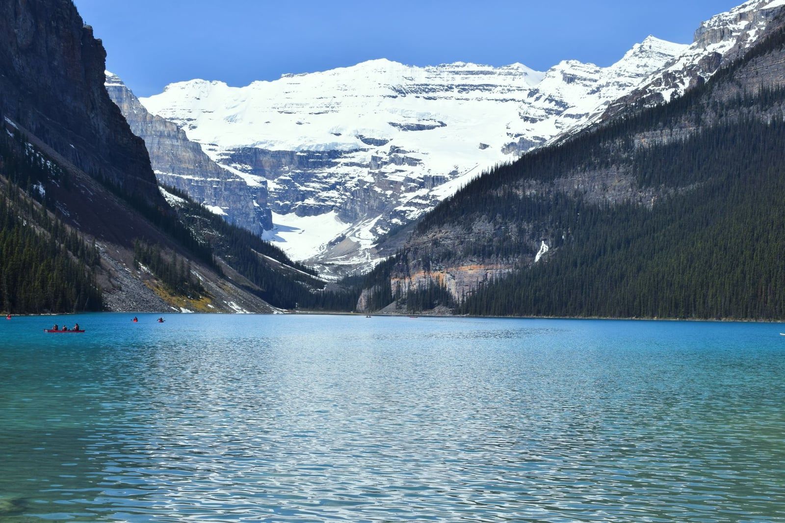
Canoes launch from the boathouse in summer, and if you want more elevation, the trail to Lake Agnes Tea House switchbacks up from the same shore. Arrive before 7 a.m. or after 5 p.m. in July and August — the lake never closes, but the parking lot effectively does.
Moraine Lake
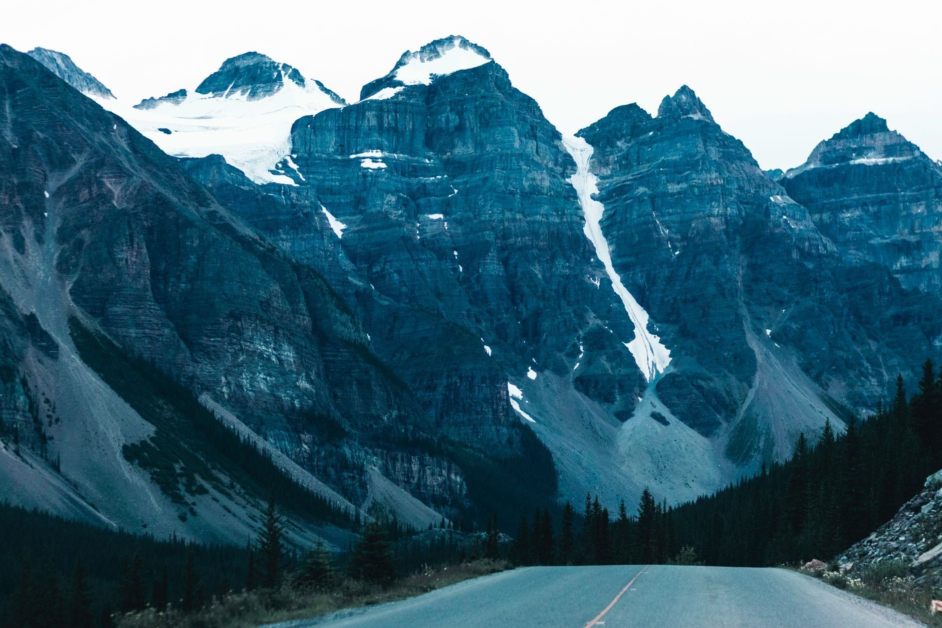
Moraine Lake sits at about 1,884 m in the Valley of the Ten Peaks, and its water runs an even deeper blue than Lake Louise's, thanks to its depth and mineral content. The short, somewhat steep climb up the Rockpile Trail delivers the view that once appeared on the Canadian $20 bill: ten jagged summits reflected in glacial water, no glacier required this time.
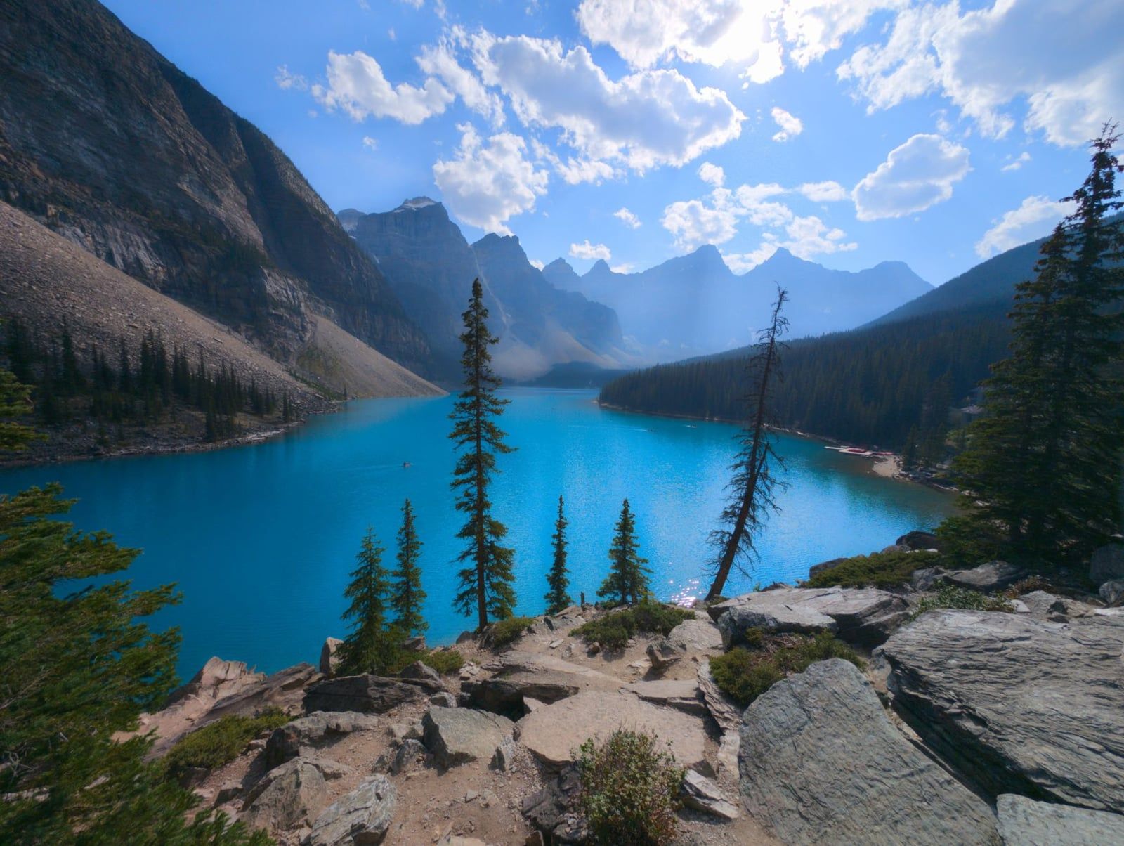
Moraine Lake Road has been closed to personal vehicles year-round since June 1, 2023. From June to mid-October the only ways in are the Parks Canada shuttle, Roam Transit, a licensed commercial operator, cycling, or being a registered guest of Moraine Lake Lodge. Show up expecting to park and you'll be turned back at the junction — plan the shuttle instead.
Getting There: Shuttle Reservations and Parking Fees
Parks Canada's seasonal shuttle to Lake Louise and Moraine Lake departs from the Lake Louise Park and Ride, and reservations go through the website or by calling 1-877-RESERVE; book online and you'll pay a $3.50 fee instead of the higher phone fee, and summer slots vanish weeks ahead. Lake Louise still has its own small lakeshore lot, but it runs about $42 CAD a day and fills within an hour of sunrise in peak season. Most visitors do better parking at the Park and Ride, or booking a seat on a tour from Calgary that handles the logistics.
Lakes Along the Icefields Parkway
Highway 93 north from Lake Louise toward the Columbia Icefield strings together five lakes worth stopping for, and the drive itself becomes the itinerary.
Herbert Lake
Herbert Lake is the first stop north of Lake Louise village, a small pond right beside the highway that mirrors Mount Temple on a still morning. There's no real trail, just a pullout and a picnic table. Easy to add for anyone driving north early, before the crowds and the wind pick up.
Hector Lake
Hector Lake is the largest natural, undammed lake in Banff National Park, reached by a short unmarked path from a pullout roughly 16 km north of Lake Louise. Almost nobody stops here compared with Bow or Peyto up the road. That's exactly the appeal if you want glacial-blue water without a tour bus in the frame.
Bow Lake
Bow Lake is the source of the Bow River, fed directly by Bow Glacier at its far end, with Num-Ti-Jah Lodge sitting on its near shore in a spot photographers have used for decades. The trailhead to Bow Glacier Falls starts from the lake's parking area, a moderate out-and-back for anyone who wants to see the ice up close rather than just its runoff.
Peyto Lake
Peyto Lake is the one everyone recognizes from the fox-shaped overlook, its color running an almost unnatural turquoise once midsummer glacial silt builds up. The main viewpoint is a short, roughly 10-minute walk from the parking area, and a paved, wheelchair-accessible path reaches a lower platform too. Go early or late — this is one of the most photographed viewpoints on the whole parkway, and the small lot fills fast.
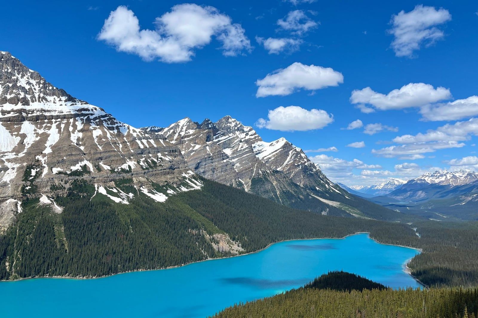
Waterfowl Lakes
Waterfowl Lakes are two connected lakes with a campground on their shore, quieter than anything else on this stretch because most traffic barrels past toward Peyto or the icefield. Stop for a picnic or a night's camping, and you'll likely have Mount Chephren's reflection mostly to yourself.
Lakes You Have to Hike To
The lakes above reward a short walk from a parking lot. These reward a real hike, and the payoff scales with the distance.
Lake Agnes
The trail to Lake Agnes Tea House climbs from Lake Louise's own shore, about 7.6 km round trip with roughly 433 m of elevation gain, and takes most hikers 2-4 hours. The teahouse at the top has served hikers since 1901, selling tea and scones from a small wooden building overlooking a lake far smaller and quieter than the one you started at.
Consolation Lakes
Consolation Lakes is the easiest add-on from Moraine Lake, a roughly 6.5 km round trip starting from the Rockpile Trail that takes 1.5-2.5 hours. The path flattens out past the initial boulder field and ends at a lake ringed by scree slopes, with none of the crowds still gathered at Moraine's viewpoint behind you.
Boom Lake and Taylor Lake
Boom Lake is a moderate half-day hike off the Bow Valley Parkway, flat enough for most fitness levels and ending at a wide lake beneath cliff walls. Taylor Lake is longer and steeper: a 12.6 km round trip with about 600 m of elevation gain. It's one of the park's best larch hikes, with golden needles carpeting the approach in late September — worth the early start for trails that thin out fast a few weeks either side of peak color.
Helen Lake, Bourgeau Lake, and Rockbound Lake
These three are the long options, each a genuine half-day-or-more commitment better suited to experienced hikers than casual visitors. Helen Lake climbs through open alpine meadow with wide views the whole way. Bourgeau Lake gains steady elevation through forest before opening onto a cirque lake. Rockbound Lake, true to its name, sits in a stony basin behind Mount Norquay with almost no tree cover left by the final approach. Start early — afternoon thunderstorms build fast at this elevation, and a guide from a local hiking tour operator can read the conditions better than a weather app.
How to Choose: Matching a Lake to Your Trip
| Lake | Drive from Banff | Access | Best For |
|---|---|---|---|
| Vermilion Lakes | 5 min | Drive-up | Wildlife & sunset |
| Two Jack Lake | 10 min | Drive-up | Swimming & families |
| Lake Minnewanka | 15 min | Drive-up | Boat cruise |
| Lake Louise | 55 min | Shuttle recommended | First-time visitors |
| Moraine Lake | 65 min | Shuttle only | Photography |
| Peyto Lake | 1.5 hr | Drive-up, short walk | Quick iconic view |
No car? Roam Transit's Route 6 reaches both Two Jack Lake and Lake Minnewanka from downtown Banff in about 25 minutes — see how to get around Banff without a car for the rest of the network.
With one day: walk Lake Louise's shore in the early morning, ride the shuttle to Moraine Lake by mid-morning, then finish at Two Jack or Johnson Lake for a swim the icons don't really allow. That sequence covers a glacier view, the Ten Peaks, and actual contact with the water without a long drive north.
Avoiding crowds: skip the two icons on a summer weekend and head for Hector Lake, Waterfowl Lakes, or Consolation Lakes instead — all deliver similar turquoise water with a fraction of the visitors. Johnson Lake beats Two Jack whenever the latter's small lot fills up.
Swimming versus viewing only: Johnson Lake and Two Jack Lake are the two spots where wading in actually feels good, since Johnson tends to run a touch warmer. Lake Louise and Moraine Lake rent canoes but rule out swimming by way of water temperature alone. Lake Minnewanka is the sole lake open to motors.
Winter changes the map entirely. Lake Louise and Two Jack Lake both get groomed for skating, and a frozen Lake Louise with ice sculptures beside it is worth the cold. Moraine Lake, by contrast, goes fully offline — its access road gets track-set for cross-country skiing, and avalanche hazard closes the lake itself. For a season-by-season plan, see our guide to Banff in winter.
Practical Tips for Visiting Banff's Lakes
Peak color runs June through September, when glacial melt is highest. Visit in May or October and the water looks more gray-green than turquoise. Book Parks Canada shuttle reservations for Lake Louise and Moraine Lake as soon as the booking window opens — summer weekends sell out weeks in advance.
Water temperature is the hazard most visitors underestimate. Even in August, glacier-fed lakes rarely climb above about 10°C, cold enough to trigger hypothermia symptoms within minutes for anyone who lingers past a quick dip. Johnson Lake and Two Jack Lake are the exceptions worth trusting.
Quieter lakes are also where wildlife shows up most: elk graze the marshes at Vermilion Lakes at dusk, and bears frequent the willow flats near Waterfowl Lakes in berry season. Keep dogs leashed — it's the law in the park — and never approach an animal for a photo. Our guide to Banff's wildlife covers what to do if you meet one on a trail.
- Shoot sunrise at Lake Louise and Moraine Lake, sunset at Vermilion Lakes.
- Bring a wetsuit for paddling, or plan to skip swimming past a quick dip.
- Fill up on gas before the Icefields Parkway; cell coverage is patchy at best.
- Carry bear spray on quieter lakeshores and trails, not buried in a pack.
Frequently asked questions
Why are the lakes in Banff National Park so blue?
Glaciers grind rock into a fine sediment called rock flour, which meltwater carries into the lakes below. Suspended in the water, it scatters sunlight and reflects blue-green wavelengths most strongly, and the effect is most vivid from June through September when glacial melt peaks.
How many lakes are in Banff National Park?
The park covers 6,641 square kilometers and holds hundreds of lakes and tarns, though most visitor guides, this one included, focus on the 10 to 30 that are actually reachable by road, shuttle, or a reasonable day hike.
Can you still drive to Moraine Lake?
No. Moraine Lake Road has been closed to personal vehicles year-round since June 1, 2023. From June to mid-October, access is by Parks Canada shuttle, Roam Transit, a licensed commercial operator, or as a registered Moraine Lake Lodge guest.
What is the best lake in Banff for swimming?
Johnson Lake is the usual pick, since its water tends to run slightly warmer than the park's other glacial lakes. Two Jack Lake is a close second, with a shallow bay suited to swimming and paddleboarding; most other lakes stay below 10°C even in summer.
Which Banff lakes can you visit without hiking?
Vermilion Lakes, Two Jack Lake, Johnson Lake, Lake Minnewanka, Bow Lake, and Peyto Lake are all reachable by short, flat walks from a parking area or shuttle stop, with no real elevation gain involved.
Is Emerald Lake part of Banff National Park?
No. Emerald Lake sits in neighboring Yoho National Park, about 45 minutes west of Lake Louise, though it's commonly lumped into 'Banff lakes' round-ups because of the short drive between the two.
What is the best time of year to see Banff's lakes at their bluest?
Roughly June through September, once seasonal glacial melt has carried enough rock flour into the water. The lakes freeze over and lose their color entirely through the winter months.
Do I need to book anything in advance to see Lake Louise or Moraine Lake?
Yes. Parks Canada shuttle reservations, booked online or by calling 1-877-RESERVE, are strongly recommended in peak season, since Moraine Lake has no public parking at all and Lake Louise's small lot fills within an hour of sunrise.